Doughton Park: Bluff Mountain and Grassy Gap Loop
Traphill, NC 28685
Map to parking/trailhead
Driving Time: Approx. 3hr drive from the triangle area.
Trail info: 13.5mi, 3200’ elevation gain
General description: This run is located west of Stone Mountain State Park at the Doughton Recreation Area, between mile markers 238.5 and 241 on the Blue Ridge Parkway and offers expansive views east and south of NC piedmont. The area includes many miles of walking/hiking trails over variable terrain from steep single track to open meadow fire roads and through cow pastures. There is a restaurant, lodge and concessions open seasonally, places for backcountry camping and lots of historical sites located within the park.
Getting There: From I-40W, take exit 188 to US-421 toward Winston-Salem. Take exit 265A to I-77 until exit 83 for US-21 bypass. After ~11 miles, turn left to Traphill Rd. Follow Traphill Rd for just over 5mi and turn right on Longbottom Rd. After 8 miles the parking area will be on the left, just before a small bridge and a tight left-hand turn. Go slow here or you may pass it.

From Longbottom Rd. Parking left, trail right.
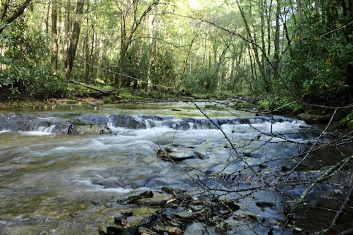
The Run: The trail begins on Grassy Gap Rd, the obvious trialhead across the street from the parking. You’ll quickly notice Cedar Ridge trail to the right, which is our return trail. Continue straight on Grassy Gap alongside the creek. You’ll pass a cool dam and waterfall on the left as you make your way to Basin Cove Campground. These first ~1.7 miles are pretty mellow and easy-going. Note that it’ll likely be extremely muddy through here. Good treads and gaiters are recommended.

Basin Creek
After you pass the large campground on the left, there will be a 3-way split. Immediately to the right is Basin Creek Trail, but continue on the road that bends left. Just past the bend will be a ST trailhead on the right, called Bluff Ridge Primitive Trail. Take it, and begin your ascent. This trail climbs ~2300’ in 2.7 miles and is very steep. These are the hardest miles of the day.
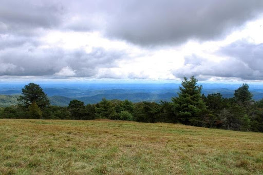
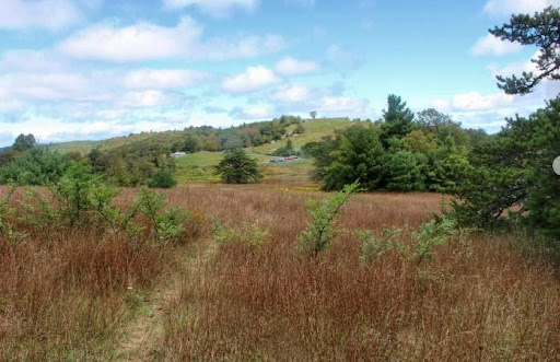
After reaching the top, and passing a small cabin on the left, continue right into a large field and head up towards the parking area. Proceed up and past it, and enjoy the rolling, grassy terrain and wide-open views of the meadow.


Grassy Balds and views after ascending Bluff Trail
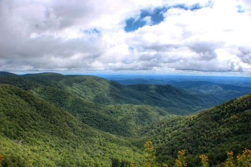
At ~5.5 total miles, you’ll notice the trail crosses a road and heads back into the woods. Turn right on the road here and take the extra 0.4mi section to Wildcat Rock Overlook - you won’t be disappointed:

Wildcat Overlook - Mile 6
For the next 2.5mi you’ll be parallelling the Blue Ridge parkway, crisscrossing often. It can be tricky finding the right path through here, and using a map/tracking device isn’t a bad idea. At around mile 9, the Bluff Mountain trail splits off left. You’ll stay right to the Cedar Ridge Trail and begin the long descent (4mi) back to the trailhead. This trail is not as steep or technical as the earlier climb. Make the final left back to the parking area to conclude the run.
Packing list: Good trail shoes and gaiters; a light wind shell; plenty of water; map or GPS device to navigate the ridge section.
Other notes: For extra water, consider a portable water filter to refill at Basin Creek, or verify the operation hours of the restaurant/concessions atop the ridge. Expect this run to take a minimum of 2.5-3 hours when planning nutrition and fuel (the steep 2.7 mile ascent will likely take over an hour).
Submitted by Scott Perry.
Latest News
Upcoming Events
R&D Brewing Run Club
6:00pm - 7:00pm | R&D Brewing - Seven Saturdays Taproom, 1399 Capital Blvd, Raleigh, NC 27603
Come run with us every Tuesday at 6pm at R&D Brewing off of Capital Blvd.
Learn More ›Nacho Average Run Club
6:30pm - 8:00pm | Taco Bamba Raleigh, 3518 Wade Ave, Raleigh, NC 27607
Join us every Wednesday at the greenspace just below Taco Bamba in the Ridgewood Shopping Ce…
Learn More ›
Connect With Us
See the latest from Fleet Feet Raleigh