The Best National Parks to Run Through
“Wilderness is not a luxury but a necessity of the human spirit, and as vital to our lives as water and good bread. A civilization which destroys what little remains of the wild, the spare, the original, is cutting itself off from its origins and betraying the principle of civilization itself.” ― Edward Abbey, Desert Solitaire
There are 60 national parks spread across the US, places protected because of their cultural, ecological, or natural significance. While upwards of 280 million tourists flock to these sacred spaces across the country, few ever experience the real treasures these landscapes have to offer. To really dive into a place in an honest, visceral way, you have to get out in the thick of it; you have to get down close to the earth far enough away that you can smell it and taste it.
In his famous book Desert Solitaire, Edward Abbey says, “A man on foot, on horseback or a bicycle, will see more, feel more, enjoy more in one mile than the motorized tourists can in a hundred miles.”
And so, get out and run through your National Parks to both explore and celebrate the diverse landscapes and ecological history of our vast country.
To kick off your research, here are three of our favorites:
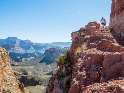
Grand Canyon National Park
Location. Northern Arizona near the Utah and Nevada border.
 Where to run. The Rim-to-rim trail is 21 miles one way (from South to North or vice versa). Schlep lightweight gear and camp on the North Rim before making the 21-mile return trip the following day. It’s become a popular route over the past decade, though, so be prepared for large crowds. If you’re really jonesing for a challenge, look up the Rim-to-rim-to-rim route (it’s an out and back with over 11,000 feet of evaluation gain in over 42 miles). Both routes too far? That’s OK; there are nearly 300 miles of trails in and around the canyon to choose from.
When to visit. You can visit the highly-trafficked South Rim year-round. The North Rim is only open—at least to vehicle traffic—after May 15. You can go in the winter, though, you just need a backcountry permit to do so.
Avoid visiting during the H-O-T summer months like the plague. Not only is the Canyon floor miserable, but it’s the park’s high season, so you’ll be hot, cranky, dehydrated, and forced to battle throngs of selfie-snapping tourists and donkey caravans.
If you’re looking for an introspective, quiet adventure, take advantage of the less-traveled North Rim. But do your research; it’s less visited because it’s harder to get to. The drive there takes almost five hours, which, for many, is just shy of how long it takes to run from rim to rim (the trail is 21 miles).
Cost. $30 per vehicle for a week; $15 per person if you’re entering the canyon by foot, bicycle, or public transportation.
Tips. Due to differences in elevation between the North and South Rims, the vegetation and climate vary drastically. If you plan to spend time on both sides (or even run from the rim to the bottom), do your research and show up prepared. You’ll need trail running shoes, nutrition and electrolytes, a hydration pack with a large fluid reservoir, sun protection (include a hat/visor and sunglasses), a layer or two for changing temps (maybe even a light wind or ran jacket), and an ID.
If you want to camp in the canyon, apply well in advance as spots fill very quickly. And, know your limits. This is the desert—it’s hot, dry, inhospitable. Carry lots of water and only run the rim-to-rim trail if you’re well trained.
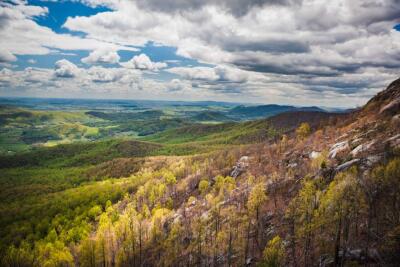
Shenandoah National Park
Location. Virginia within a two-drive from Washington D.C.
 Where to run. Over 500 miles of trails meander through 200,000 acres of magical, rolling, wooded land here. You can hop on the Appalachian Trail (in fact around 100 miles cross through the park) and stitch together a loop by way of the 2.8-mile Hawksbill Trail. Add on some out-and-back AT miles or study the map for a longer loop to incorporate some of the park’s waterfalls. Don’t be fooled by the distance, though; it packs nearly 900 vertical feet of elevation gain in just over a mile … but also a good resting spot at the top.
Or, check out the Old Rag Summit, a bald summit—a rare gem on the east coast—with panoramic views. It’s a popular trek, so it’s a near certainty you’ll pass people en route. Still, it’s close to nine technical miles with 2300 feet of elevation gain. So, wear grippy trail running shoes, and come prepared with a hydration pack with a large water reservoir.
When to visit. Late spring and fall are the best. Spring is often cooler, and dryer and fall offer a dazzling display of breathtaking leaves. While the autumn leaves are spectacular, so are the number of leaf-peeping tourists. If you go during this high season, start your run in the dark and catch the sunrise on a misty summit (but check the weather; summit views are often best in the late afternoon or early evening). If you go in the summer, take advantage of the park’s numerous waterfalls to cool off.
Cost. $20 per vehicle for seven days.
Tips. If you plan to camp, you’ll need a permit. Bugs can get quite pesky in the South's humid climate, so wear bug spray to prevent bites and sunglasses to keep them out of your eyes. When you’re done running always check for ticks.
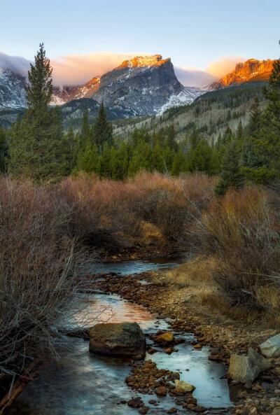
Rocky Mountain National Park
Location. The park is in Northwestern Colorado and easily accessible from Colorado’s front range.
 Where to run. This high-altitude park (the highest peak tops out at over 14,00 feet), is home to diverse wildlife (including mountain lions, bears, and elk) and 300 miles of trails.
For a short, classic run, check out Dream Lakes. It’ll put you back three miles roundtrip and offer a turn-around reward: glassy Dream Lake beneath towering rocky mountain faces.
If you’re looking for something on the more challenging side, Longs Peak is a classic—and difficult—route. But you don’t need to get to the top to enjoy it. In fact, we recommend that you don’t. A simple out-and-back along the trail that takes you to Lion Lakes (14 miles roundtrip) offers panoramic above-treeline-views, zigzagging singletrack, and a high-altitude experience with minimal exposure.
If you’re still considering summiting, be warned: only do so if you’re an experienced mountain athlete. At 14,259 feet, getting to Longs Summit is a hairy and arduous operation that requires exposed scrambling (a fall near the summit would be fatal). The Keyhole route is popular so, if too many people are on the mountain at once, falling rocks add another element of danger, as does classic high alpine weather (in addition to thunderstorms, the wind near the summit of Longs can be brutal).
When to visit. Snow in the high Rockies sticks around well into June. So, late summer is best for really exploring the high country. August comes with more thunderstorms, though, so start your adventures early.
Cost. $20 per vehicle for seven days.
Tips. Know your ability before you set out. High alpine running means quickly-changing weather, potentially dangerous wildlife encounters, and traversing exposed ridge lines. You’ll need comfortable trail running shoes, a hydration pack with a large water reservoir, ID, sun and wind protection, extra layers for the cold (a wind jacket with a hood is a good option), bear spray, and maybe even trekking poles.
If you go in the late summer, set out early to avoid being above tree line in an afternoon thunderstorm—“alpine starts” are recommended for a reason.
Connect With Us
see the latest from Fleet Feet St. Louis