
Here is a list of some popular walk/run routes in the Springfield area!
If you are looking to go off-road and on to some dirt trails see here: Fellows Lake Trails, Busiek State Forset, & Two Rivers MTB Park
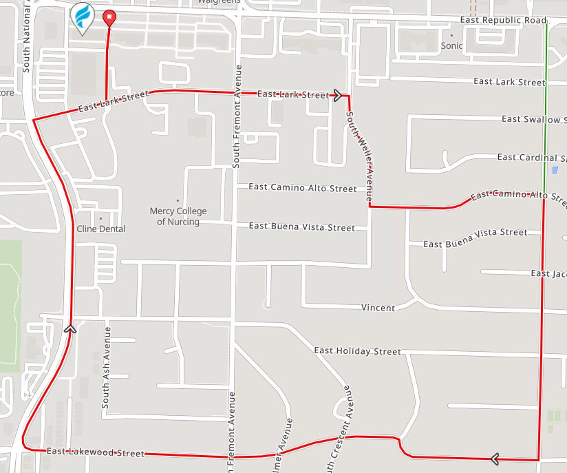
The Big Run Route: https://ridewithgps.com/routes/49273975
- Location: Fleet Feet Springfield
- Length: 3.1 miles
- Surface: Paved
This is our classic Global Running Day 5K route. It is mostly flat with a couple short hills run clockwise.
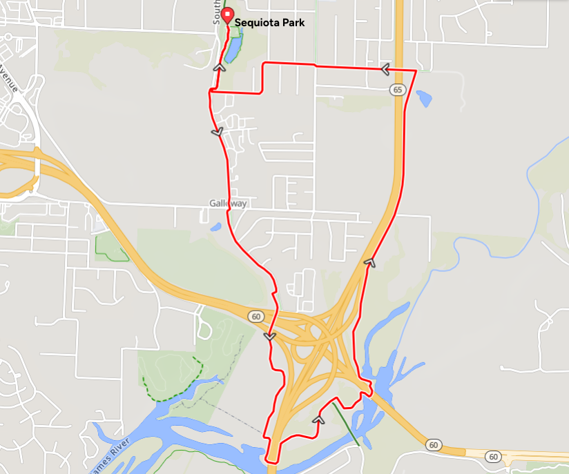
Sequiota Loop: https://ridewithgps.com/routes/49274123
- Location: Sequiota Park
- Length: 5.7 miles
- Trail Surface: Paved
Following the Galloway Creek Greenway, this route takes you under highway 60 and 65 climbing out from the James River for a fair amount of elevation change.
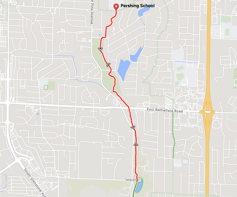
Pershing to Sequiota Out & Back: https://ridewithgps.com/routes/49275244
- Location: Pershing Elementary & Middle School
- Length: 4.2 miles
- Trail Surface: Paved
Starting at Pershing Elementary/Middle School, this route heads south on the Galloway Creek Greenway to Sequiota Park and back. Slightly down hill out and slightly uphill back. A route that could easily be made longer as the Greenway continues on farther south. See here.
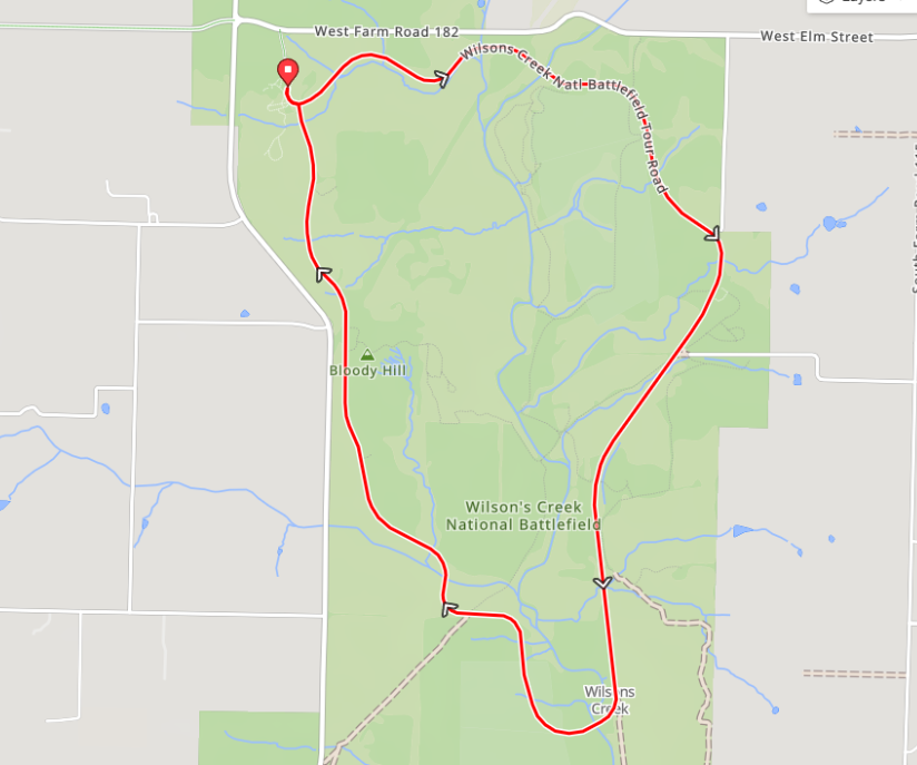
Wilson's Creek: https://ridewithgps.com/routes/49274246
- Location: Wilson's Creek National Battlefield
- Length: 5 miles
- Surface: Paved
This is a low traffic 4.9 mile paved loop around Wilson's Creek National Battlefield. Expect some rolling to large hills!
Learn more about Wilson's Creek here.
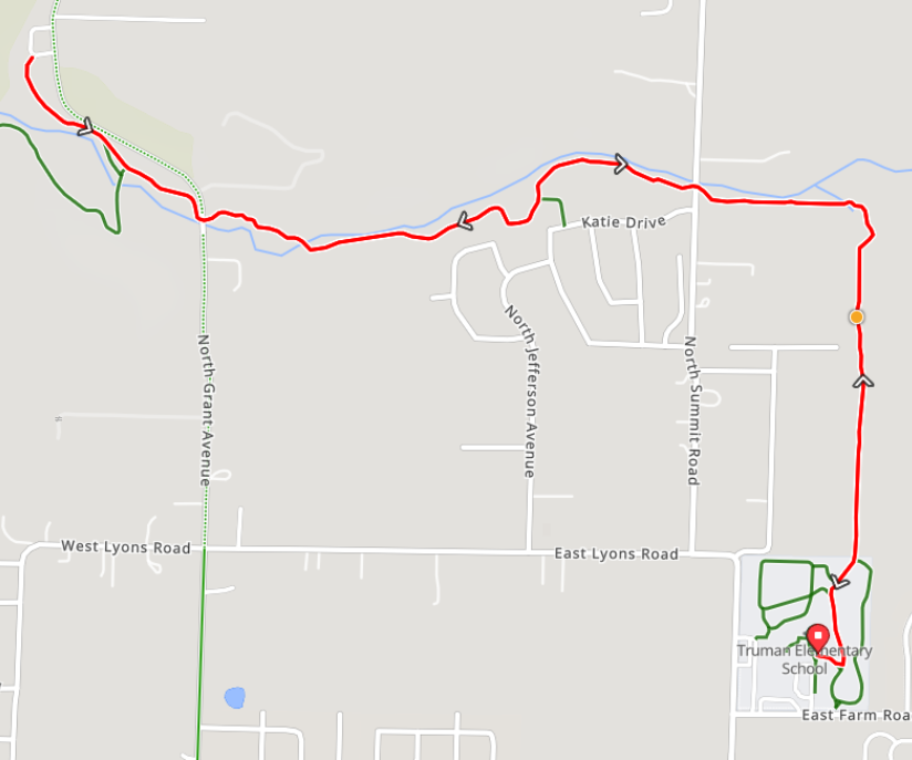
Truman Elementary Out & Back: https://ridewithgps.com/routes/49275000
- Location: Truman Elementary
- Length: 4.7 miles
- Trail Surface: Paved
An out and back run from Truman Elemtary to Lost Hills Park and back on the Fulbright Spring Greenway. A route that could easily be made longer as the Greenway continues on farther to the west.
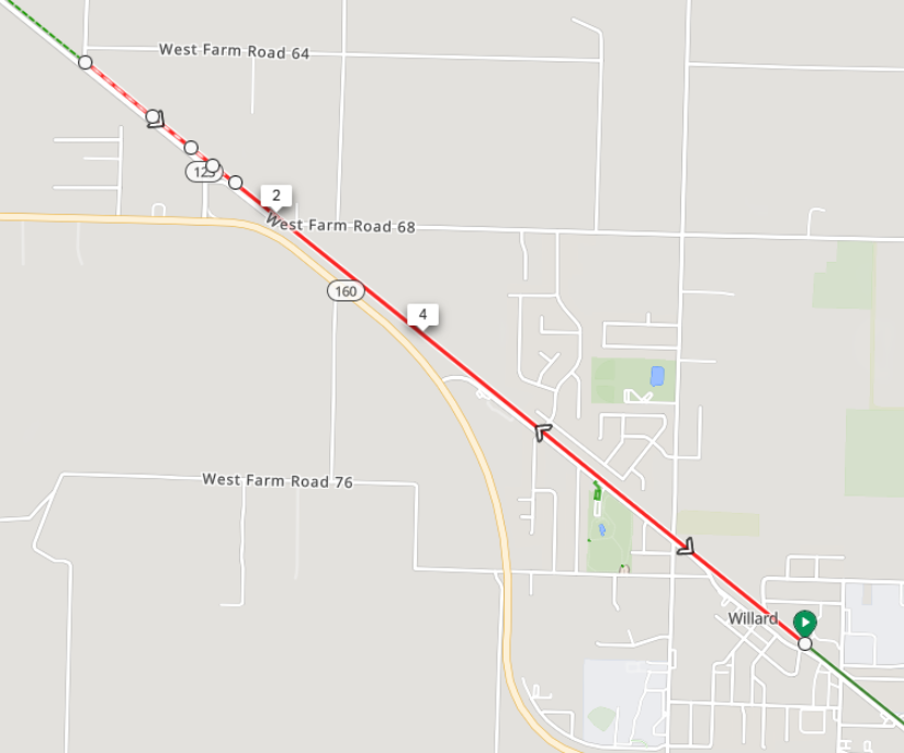
Frisco Trail Out & Back: https://ridewithgps.com/routes/49275054
- Location: Willard Middle School
- Length: 5.4 miles
- Trail Surface: Paved/Chat
This is an example of a Frisco Highline Trail Out & Back starting from the Willard Middle School to Farm Road 81 and back. The Frisco Highline Trail heads north from Springfield for about 35 miles making it one of the best running/walking trails in Missouri!
On this route the paved trail turns to chat right after the 2 mile mark. Read more about the Frisco Highline Trail here.
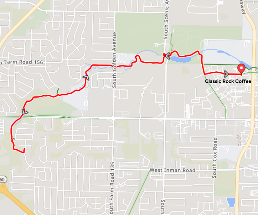
Classic Rock-South Creek Trail: https://ridewithgps.com/routes/49275104
- Location: Classic Rock Coffee
- Length: 7.2 miles
- Trail Surface: Paved
Starting at Classic Rock Coffee with easy access to the South Creek Greenway and heading to the west end and back for about 7 miles. This route could easily become a long run destination as the trail also goes to the east of Classic Rock Coffee.
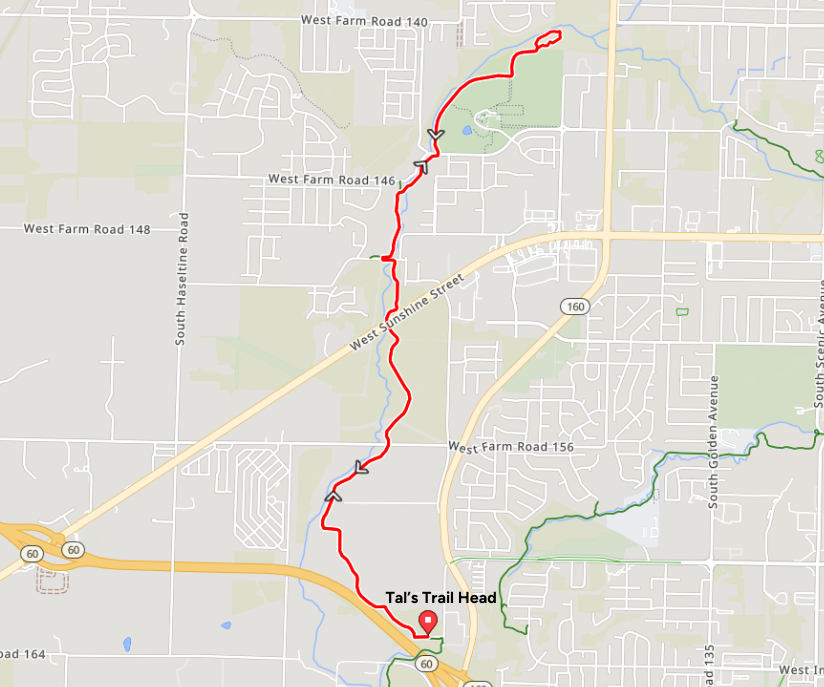
Tal's Trail Head: https://ridewithgps.com/routes/49275149
- Location: Tal's Trail Head
- Length: 8.2 miles
- Trail Surface: Paved
Starting at Tal's Trail Head and heading north on the Wilson's Creek Greenway to Rutlede-Wilson Farm Park and back for about 8 miles.
Connect With Us
See the latest from Fleet Feet Springfield